


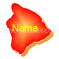
Hawaii County PUMA, Hawaii
About
Outline

Summary
| Unique Area Identifier | 192761 |
| Name | Hawaii County PUMA |
| State | Hawaii |
| Area (square miles) | 5,086.13 |
| Land Area (square miles) | 4,028.42 |
| Water Area (square miles) | 1,057.72 |
| % of Land Area | 79.20 |
| % of Water Area | 20.80 |
| Latitude of the Internal Point | 19.59776430 |
| Longtitude of the Internal Point | -155.50244340 |
Maps

Graphs
Select a template below for downloading or customizing gragh for Hawaii County PUMA, Hawaii


Neighbors
Top 10 Neighboring County (by Population) Neighboring County on the Map
Top 10 Neighboring County Subdivision (by Population) Neighboring County Subdivision on the Map
- Hilo CCD, Hawaii County, HI (45,714)
- North Kona CCD, Hawaii County, HI (37,875)
- Keaau-Mountain View CCD, Hawaii County, HI (34,266)
- South Kohala CCD, Hawaii County, HI (17,627)
- Pahoa-Kalapana CCD, Hawaii County, HI (11,060)
- South Kona CCD, Hawaii County, HI (9,997)
- Kau CCD, Hawaii County, HI (8,451)
- North Kohala CCD, Hawaii County, HI (6,322)
- Papaikou-Wailea CCD, Hawaii County, HI (5,213)
- Honokaa-Kukuihaele CCD, Hawaii County, HI (3,925)
Top 10 Neighboring Place (by Population) Neighboring Place on the Map
- Hilo CDP, HI (43,263)
- Kailua CDP, HI (11,975)
- Hawaiian Paradise Park CDP, HI (11,404)
- Kalaoa CDP, HI (9,644)
- Waimea CDP, HI (9,212)
- Holualoa CDP, HI (8,538)
- Waikoloa Village CDP, HI (6,362)
- Hawaiian Ocean View CDP, HI (4,437)
- Hawaiian Beaches CDP, HI (4,280)
- Mountain View CDP, HI (3,924)
Top 10 Neighboring Unified School District (by Population) Neighboring Unified School District on the Map
Top 10 Neighboring State Legislative District Lower Chamber (by Population) Neighboring State Legislative District Lower Chamber on the Map
- State House District 4, HI (33,276)
- State House District 7, HI (27,674)
- State House District 5, HI (27,586)
- State House District 6, HI (26,582)
- State House District 3, HI (23,425)
- State House District 2, HI (23,279)
- State House District 1, HI (23,257)
- State House Districts not defined, HI (0)
Top 10 Neighboring State Legislative District Upper Chamber (by Population) Neighboring State Legislative District Upper Chamber on the Map
- State Senate District 2, HI (67,568)
- State Senate District 3, HI (61,703)
- State Senate District 1, HI (55,808)
- State Senate Districts not defined, HI (0)
Top 10 Neighboring 111th Congressional District (by Population) Neighboring 111th Congressional District on the Map
Top 10 Neighboring Census Tract (by Population) Neighboring Census Tract on the Map
- Census Tract 210.05, Hawaii County, HI (11,012)
- Census Tract 217.02, Hawaii County, HI (9,540)
- Census Tract 215.07, Hawaii County, HI (8,503)
- Census Tract 212.02, Hawaii County, HI (8,451)
- Census Tract 217.04, Hawaii County, HI (8,087)
- Census Tract 210.10, Hawaii County, HI (7,884)
- Census Tract 216.01, Hawaii County, HI (7,822)
- Census Tract 216.04, Hawaii County, HI (7,587)
- Census Tract 211.06, Hawaii County, HI (7,529)
- Census Tract 210.03, Hawaii County, HI (6,391)
Top 10 Neighboring 5-Digit ZIP Code Tabulation Area (by Population) Neighboring 5-Digit ZIP Code Tabulation Area on the Map
- 96720, HI (46,165)
- 96740, HI (33,321)
- 96749, HI (17,047)
- 96778, HI (14,409)
- 96743, HI (12,160)
- 96771, HI (8,339)
- 96738, HI (6,609)
- 96704, HI (6,505)
- 96727, HI (4,878)
- 96737, HI (4,552)